
Two unusually low-flying research aircraft are set to trace a tight grid over eastern Kansas, gathering magnetic and radiometric measurements for a new map of the rocks beneath the region.
The U.S. Geological Survey said flights could begin as soon as late July. The fixed-wing planes will follow preplanned lines about 980 feet, or 300 meters, apart while maintaining a nominal terrain clearance of about 260 feet, or 80 meters.
The planes carry passive sensors, not cameras
An Air Tractor AT-504 and a Pilatus PC-6 will carry sensors in an elongated boom, or “stinger,” extending from the main cabin. USGS said the instruments are passive, emit nothing that poses a risk to people, animals or plants, and will not collect photography or video.

The contractor, New Resolution Geophysics Exploration USA, will fly during daylight. Pilots are specially trained and approved for low-level work and coordinate with the Federal Aviation Administration, according to the agency.
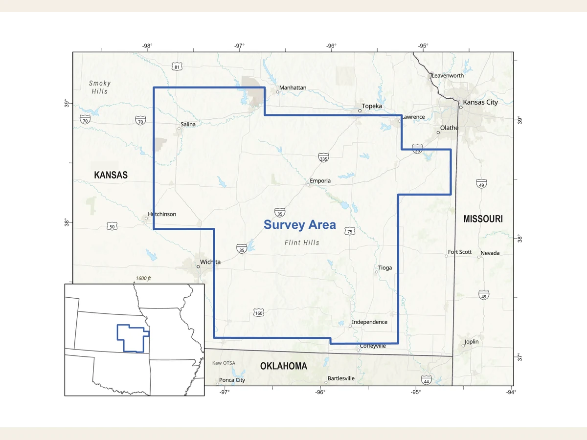
Operations will be based at Coffey County, Salina Regional and Newton City-County airports. The announced route covers a broad band of counties from the Kansas City region south toward the Oklahoma line and west toward Salina and Wichita.
The target is the Nemaha Uplift—and more than minerals
The survey centers on the Nemaha Uplift, a buried ridge extending from southern Nebraska into central Oklahoma. The region includes coal and petroleum resources, rocks with critical-mineral potential and the Humboldt Fault Zone, an active fault system that parallels the uplift.
USGS and the Kansas Geological Survey say the measurements can sharpen geologic maps used to assess mineral resources, geologic hydrogen, groundwater, earthquake hazards, infrastructure conditions and land-use questions. The flight data alone will not establish that an economically recoverable deposit exists.
The work is part of the federal Earth Mapping Resources Initiative, which combines airborne geophysics with geochemistry, lidar, hyperspectral surveys and field mapping. USGS says the resulting datasets will be released publicly through ScienceBase.
What residents should expect
Because the planes will fly much lower and in straighter, more repetitive patterns than typical traffic, they may be conspicuous from the ground. The agency says the schedule depends on weather, aircraft availability and other operational conditions.
The mapped boundary is provisional. USGS listed additional counties in Kansas, Missouri, Oklahoma and Arkansas that could be added, so the final footprint may be wider than the initial blue outline.