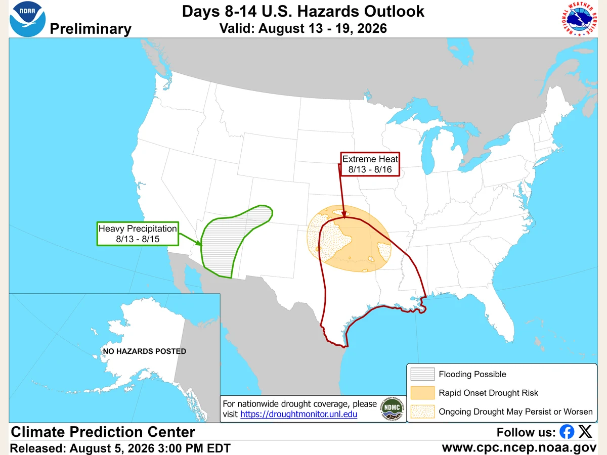
NOAA’s latest week-two hazards outlook places three very different risks on the same national map: extreme heat across much of the South, heavy monsoon rain in the Southwest and the possibility of rapid-onset drought in parts of the Plains and Mississippi Valley.
The Climate Prediction Center product, issued Aug. 5 for the period Aug. 13 through Aug. 19, is a regional risk assessment rather than a day-by-day local forecast. It highlights where forecast models and recent conditions support elevated concern eight to 14 days ahead.
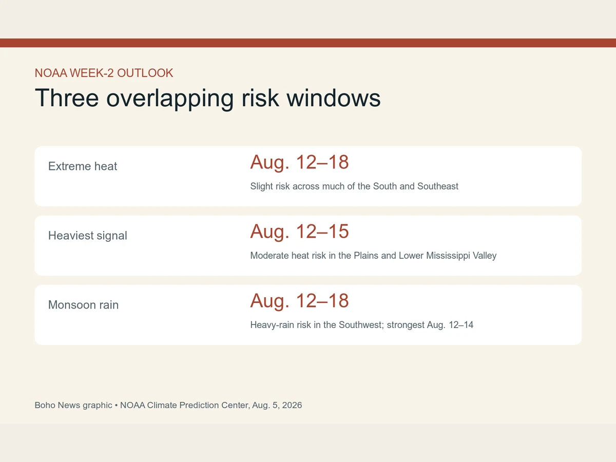
A moderate risk of extreme heat covers parts of the Southern and Central Plains and the Lower Mississippi Valley for Aug. 12 through Aug. 15. A wider slight-risk area extends across much of the south-central United States, Southeast and Mid-Atlantic through Aug. 18.
The heat signal strengthened east of the Rockies
NOAA tied the heat risk to persistent high pressure and humid air moving north from the Gulf. Its combined GEFS and ECMWF tool showed at least a 40% chance across broad areas that maximum temperature or heat index would exceed the local 90th percentile at some point during the period.
The strongest modeled signal reached as high as 70% in parts of the Lower Mississippi Valley. Those probabilities describe conditions relative to local climate, not a single temperature threshold shared by every city.
The outlook discontinued an earlier heat-risk area for the Intermountain West and Northern Plains as models increasingly favored a West Coast trough and moderating temperatures there. Forecast confidence was higher in the southern heat signal than in earlier runs, the discussion said.
The Southwest could move in the opposite direction
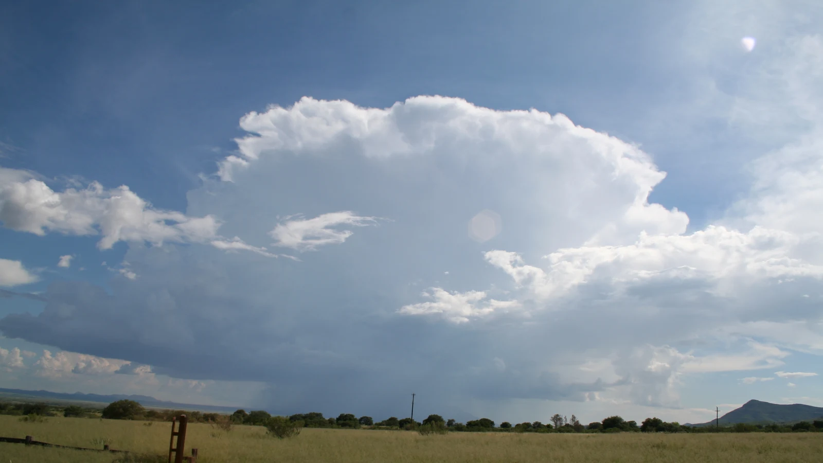
The same developing western trough may help draw more moisture into the Southwest monsoon. NOAA posted a moderate risk of heavy precipitation for parts of the Desert Southwest and southern Great Basin from Aug. 12 through Aug. 14, with a broader slight-risk area lasting through Aug. 18.
Model ensembles showed widespread chances above 50% for three-day precipitation totals to exceed half an inch in parts of the region, with smaller areas carrying a 20% chance of more than one inch. In dry washes and canyons, relatively modest totals can still produce flash flooding.
A separate slight-risk area for heavy precipitation covers parts of the Great Lakes, Ohio Valley and Upper Mississippi Valley early in the period. NOAA said humid air and possible mesoscale convective systems could support intense rainfall, while acknowledging that models disagreed on the evolving upper-level pattern.
Rapid-onset drought remains possible between the rain signals
Parts of the Central and Southern Plains, the Ozarks and the Lower and Middle Mississippi Valley carry a rapid-onset drought designation. NOAA cited 30-day precipitation deficits greater than two inches in portions of that area, along with continued heat and dryness into mid-August.
Rapid-onset drought is not simply a long dry spell. It describes deterioration that accelerates over weeks as limited rain combines with high temperatures, wind and atmospheric demand for moisture. The risk designation signals favorable conditions for that process; it does not certify that every county inside the boundary will enter drought.
Because the product looks more than a week ahead, exact hazard boundaries and timing can shift. NOAA directs readers to local National Weather Service offices for short-range, location-specific forecasts and warnings.
The larger lesson is visible in the map’s contrasts. A stronger monsoon can raise flash-flood risk in the Southwest while persistent heat and rainfall deficits worsen soil moisture farther east. National weather does not move as one condition, even within the same forecast week.